File:County-land-ownership-map-1895-IN-vigo.jpg
From MouserAncestry
Size of this preview: 800 × 590 pixels.
Full resolution (3,213 × 2,369 pixels, file size: 1.37 MB, MIME type: image/jpeg)
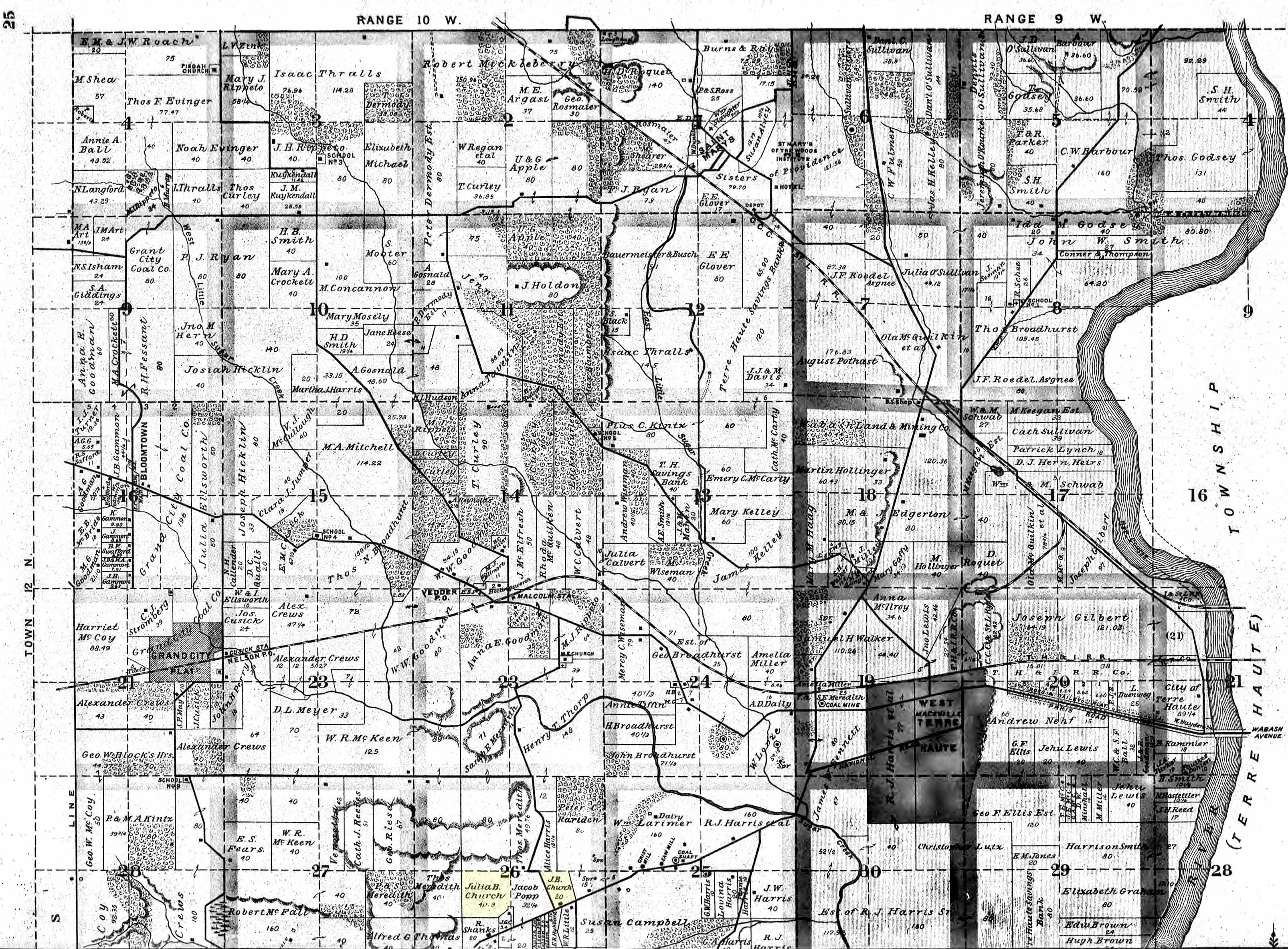
County Land Ownership Map for Vigo Co., IN in 1895. There are two parcels of land here owned by Julia B. Church, widow of Erastus Warren Church.
File history
Click on a date/time to view the file as it appeared at that time.
| Date/Time | Thumbnail | Dimensions | User | Comment | |
|---|---|---|---|---|---|
| current | 13:19, 21 March 2012 | | 3,213 × 2,369 (1.37 MB) | Mouser (Talk | contribs) | County Land Ownership Map for Vigo Co., IN in 1895. There are two parcels of land here owned by Julia B. Church, widow of Erastus Warren Church. |
- You cannot overwrite this file.
- Edit this file using an external application (See the setup instructions for more information)
File usage
The following page links to this file: